Satellite Imagery Reveals China Has Built a Sprawling New Island Base in the South China Sea
New satellite imagery shows China has constructed a large artificial island in the South China Sea, raising militarization concerns.
China has constructed a substantial new artificial island in the South China Sea, satellite imagery analyzed by The War Zone reveals, adding another potential military outpost to Beijing’s already extensive network of man-made features across the disputed waterway. The War Zone reporting shows the island taking shape with infrastructure consistent with prior Chinese island-building efforts that preceded full militarization. The development comes as regional tensions over South China Sea sovereignty remain unresolved and as Beijing continues to assert expansive territorial claims that most of the international community does not recognize. For context on how Beijing’s broader technological ambitions intersect with its military posture, see GDD’s earlier coverage of Chinese rocket developments and their defense implications.
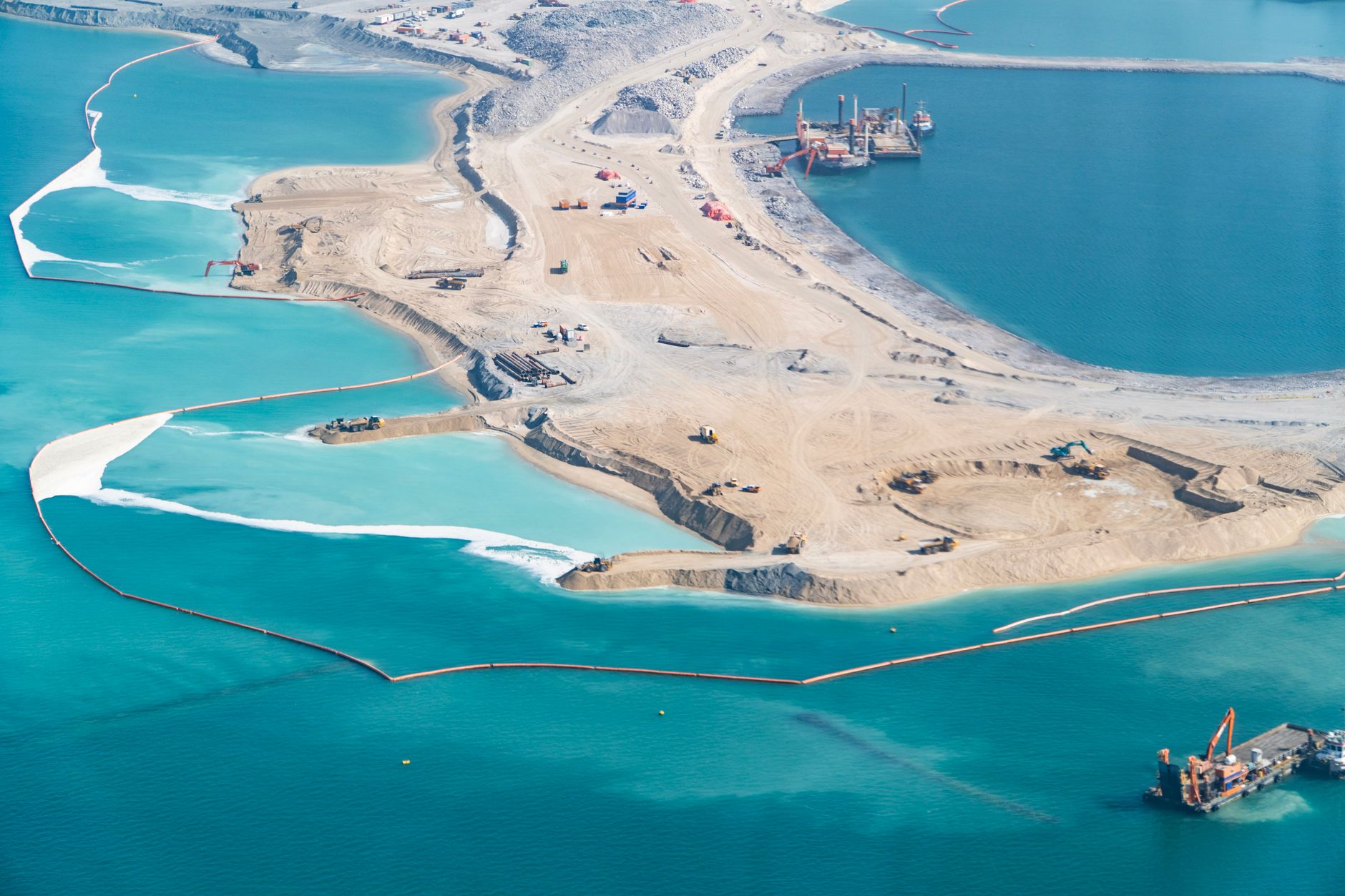
The island’s scale and layout place it in a category that mirrors the progression Beijing followed at Fiery Cross Reef, Subi Reef, and Mischief Reef — features that were built up incrementally before receiving airstrips, radar arrays, hangars, and missile batteries. Officials have not publicly confirmed the island’s intended military purpose, but the physical characteristics documented in the satellite imagery are consistent with designs optimized for dual-use or outright military functions.
Strategic Position and Regional Implications
The location of the new feature matters as much as its physical footprint. The South China Sea is one of the world’s most heavily transited bodies of water, carrying an estimated fraction of global maritime trade annually, and control over island features within it provides surveillance, logistical, and power-projection advantages that extend well beyond the immediate reef. China’s established island bases already enable People’s Liberation Army Navy and Air Force assets to operate at ranges that would otherwise require carrier or expeditionary support.
The Philippines, which has overlapping claims in the region, secured a landmark 2016 arbitral tribunal ruling that invalidated Beijing’s broad territorial claims under international law — a ruling China has consistently rejected. As a Forbes analysis notes, Beijing has labeled that decision “waste paper,” yet the ruling continues to shape the legal framework within which regional actors and their partners operate. The emergence of yet another artificial island underscores how little legal pressure has slowed China’s physical construction activity.
Militarization Trajectory and U.S. Response
The pattern established at earlier Chinese island features is well documented. Construction begins with dredging and land reclamation, followed by port and logistics infrastructure, then hardened facilities capable of hosting aircraft, sensors, and weapons systems. There is no public indication that this new island has yet reached the later stages of that progression, but the War Zone’s analysis suggests the groundwork is being laid for capabilities that would extend Beijing’s operational reach further into the maritime domain.
Taiwan, which monitors Chinese military activity in the region closely, has been increasing its own defense spending in parallel — the island democracy recently set a record defense budget of $35 billion as cross-strait pressure intensifies. U.S. Indo-Pacific Command has conducted freedom-of-navigation operations in the South China Sea, but those transits have not halted China’s construction activity. Whether the new island triggers a formal diplomatic response from Washington or regional partners has not been reported.
For now, the satellite record provides the clearest accounting of where things stand: China has added another physical fact on the water, and the infrastructure visible in imagery is consistent with a feature designed to be expanded and, ultimately, armed.